Gunung Angsi: Of bee stings, leeches and precautionary measures!

A couple of friends made a plan yesterday to hike up Gunung Angsi which is located in Negeri Sembilan. It was quite an experience for me; an astonishing one.

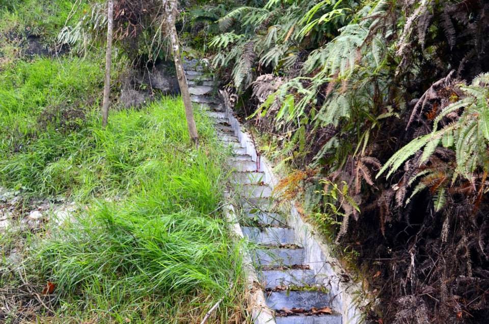
We started our hiking not so early, it was around 9 a.m. The trail was wet because it was raining heavily a day before. After 20-25 minutes (fast steps) of hiking, most of my friends got stung by the bees including me too! It was pretty hard to notice the presence of bees in front of the trail earlier. Bees’ bites caused a little pain but since they were not very harmful that moment, we decided to continue our journey to the summit. After another 20 minutes of hiking, one of my friends who got stung by the bee complained that he felt numbness on his face and his whole body started to get really itchy. I was panicked and our team was a bit worried about his condition hence we decided to stop immediately and gave him plenty of water. We then asked him to get some rest and we hoped he would feel better. Unfortunately, he could not calm himself; his heartbeat increased rapidly that he felt painful and difficult to breathe. In addition, there was no phone signal (reception) to call the registration office for help. We were in such a critical situation; there was no choice – one of our team members started to run towards the base to seek for help. Meanwhile, my friends and I stayed to look after the other friend who was in pain. Sadly he was getting worst because his face & hand was swollen and he was getting much more difficult to breathe and kept vomiting. Don’t ask us why we didn’t carry him down; the condition of his body did not allow us to plus we did not have much experience as well (I guess I need to start enrolling in paramedic classes).

After a while, he started to move slowly and bearing with the pain. Along the way, we bumped into a few groups of people and most of them said that they were also got stung by the bees. While we were walking back returning to the base, we passed by the “bees attacking point” with an alternative small path close to a waterfall. At this point, we met a big group of hikers and the leader offered some medicine to my friend. Thanks for his help but it had worsened my poor friend’s situation. My friend who ran to the base earlier, managed to get help from the personnel of Civil Defence Department (Jabatan Pertahan Awam) and we met them on our way to the base. They started to assist my friend until we reached the base (in 10 minutes we got to the base). They didn’t provide any medicine because they mentioned that our friend was suffering from allergic reaction and could not simply gave him any medication. Right after, we rushed him to the nearest clinic. Again…again we were so unlucky that the doctor in the clinic said, “He is in trauma, you need to immediately rush him to the hospital.” We straight away brought him to Seremban General Hospital (GH) and the doctors quickly admitted him to the emergency room and treated him. He was stable 2 hours later and slowly recovering.

We got in touch on Facebook Group with the hiking experts and those who often hike on some queries - What is the best approach to handle this kind of situation (bee stings)? How can we prevent from getting sucked by leeches? The area has a lot of them especially after it rained. We are very grateful that they were helpful in giving several advices and tips. Thank you guys! :)

To sum it up here are the things that you need to consider bringing along when you are coming over to Gunung Angsi or on any other adventurous activities:

1. First aid kit with Prednisone steroid, antihistamine, Prednisolone, Cetirizin, or Polaramine
  • Prednisone: It is used to treat certain inflammatory diseases (such as moderate allergic reactions)
  • Antihistamines: Work well to relieve symptoms of different types of allergies (More info)
  • Prednisolon: Used to treat many different conditions such as allergic disorders (More info)
  • Cetirizine: An antihistamine used in the treatment of hay fever and allergies
  • Polaramine (dexchlorpheniramine): Used to treat sneezing; runny nose; itching, watery eyes; hives; rashes; itching; and other symptoms of allergies and the common cold (More info)
2. To ease bee sting symptoms are toothpaste and ice
3. Bite & sting extractor kit --> More info
4. For leeches, wear leech socks --> More info

Safety has to come first in mind, nature lovers! :)


Hikers, trekkers, nature lovers; you got to come here - Gunung Telapak Buruk, Negeri Sembilan.

It was a jumpsuit plan. We did not get to plan much earlier but we were glad it went well. At the very last minute, our team decided to visit the mountain where few years ago there was an aircraft crash. The area is situated at Gunung Telapak Buruk, in Negeri Sembilan. From the Seremban exit, you need to look for Kuala Klawang and you will be on the right route.

We managed to do some research before our trip even it was not a thorough one. Make sure to do some survey before deciding on your trip. It's important to know what the place is like, what amenities do they have, what you will expect when you're there etc. In shorter words, always be prepared. We're started our adventure from the main road junction and it took us 3 hours walk to reach telecommunication tower (about 12km from the place we parked our car). Generally you can reach the telecommucation tower by car (preferable 4WD since the road is not so even for normal cars and you never want to damage your cars) but since our friend requested for a tough trip, we decided to walk. Along the walk, we did not know the distance to the telecommunication tower and we could not imagine how far it was going to be. Hihi.. There was a huge group came after us to visit the airplane crash area too and we met them at the telecommunication tower.

We had some discussion before we continued our journey to the crash area. We had to walk for about another 1 hour 30 minutes to reach the airplane crash area. (It was a little slow since we spent some time taking photos, looked around and also because of my slow steps ). After our first stop, ee continued our steps further ~1.5 hours before we made a U-turn to the telecommunication tower. Finally we were back to the initial starting point, which was the telecommunication tower at around 5p.m. It was our lucky day, the team which we met earlier was still hanging around and we followed them to reach the main road by a 4WD. Our team completed around 28.5km (20km - up the mountain and coming down around 8.5km - just a rough estimation). It was pretty good exercise for us.

Just some advice for beginners or first timers to this place:
1. It is good to wear track suit and long sleeve t-shirts. Along the way, there is a lot of plants with thorns
2. Watch out your steps because the track is not as clear as the famous mountains'
3. Always stick with your group or team members. During our hiking, only 3 of us were there in the mid of the jungle! We did not see anyone except at the telecommunication tower. Probably it might be due to less visitos at that time but we were not quite sure either.
4. Drinking water supply is important. Make sure to bring sufficient water because we were already out of water towards the end of the journey.

There is no dedicated signage saying 'Gunung Telapak Buruk'. Once you observe this signboard, if you are from Seremban, you need to make a right turn.
 

Distance is about 12km from the signage you'll see earlier. You may opt to walk but it is highly recommended to drive up to this communication tower.


Meeting and making new friends! Outdoor activity is another way of creating good network.


'Hutan Simpanan Kekal' translated to 'Reserved Forest' in English.


It was in 1945 that we lost them.
 

Bits and pieces from the airplane crash.


Mount Kinabalu, Malaysia - Conquered!


Standing tall in the East Malaysian state of Sabah, Mount Kinabalu is the highest peak in Borneo and the 20th most prominent mountain in the world. We were very lucky to have the opportunity hiking up 4.095km and conquered the peak! The summit plateau, Low’s Peak is named after Hugh Low in March 1851. It takes about 2 days to climb up and it is not necessary to have previous experience in mountain climbing. Nevertheless, it is advised to be physically as well as mentally fit to push through lethargy throughout the hike. Above animated pictures show the trail map of Mount Kinabalu. There are two ways to reach summit trail which are Timpohon Gate and Mesilau Gate.

The distance from Timpohon gate is shorter by 2km compared with Mesilau track which is 6km. Eventhough Timpohon track is shorter but it is considered as the toughest track with steep path as compared with Mesilau. Hikers who love the natural view would prefer to take Mesilau track to enjoy the mind blowing natural view.


This picture was taken once our team arrived at Kinabalu park.  From here, we took a van to Mesilau Nature Resort.
 
Day 1
We spent a night at Mesilau Nature Resort. The place is very clean, comfortable and there was a good service by friendly resort staff.
Room view from outside.

Such a pleasant environment

Restaurant is placed just a few metres away from our room and dinner serving time is 6.30p.m.

After our heavy dinner, we walked around the restaurant area to enjoy the nice cool weather and views. Since our mobile signal coverage in the room is very poor, we decided to settle all calls at the restaurant area. Nevertheless, do not be worried because during your hiking period you can still bring your mobile phone - along the way to Summit, the mobile line coverage is good.

Above picture is the Mersilau track starting point and every hiker needs to register themselves in the morning before start their journey. A group of 1-5 persons will have one guide and this guide will give you a short briefing before the journey. The guide will follow the slowest member in a team and they can also help you to carry your bags but you will be charged based on the weight of your bag.

This are our recommendation during hiking:

- Do not carry heavy bag unless you are used to it. (preferably, the weight is less than 5KG)
Tips to reduce weight of your bag:
- If you are carrying a backpack, you can refer to their arrangement techniques in the internet
- Sharing is caring (you don't need to bring everything by yourself, align with your   friends who to bring what)
- Always stick to your group. If you have a big group, you may split into several groups. (for our case, we were divided into two groups; Fast and Slow ;-) )

- For beginners, you need to be slow and steady. Just walk slowly while enjoy seeing the beautiful scenery. You can have a short break at every checkpoint.

- Be careful with your steps and do not push yourself too hard. We recommend hikers to use small steps in order to save energy.

These are the necessities needed to be prepared beforehand:
(Some sources are from Climb Mt. Kinabalu)
Clothing
Waterproof jacket or a ponco (high chances for it to rain in the evening
Warm, lightweight jumper and warm, lightweight pants
Spare socks and under garments
Beanie or wool-knitted hat
Fleece or wool-knitted gloves

Miscellaneous
Snacks (granola bars are the best option, banana as your source of energy) for the climb
Water bottles (at least one litre, preferably in small bottles)
Sunscreen cream
Small first aid kit
Whistle (in case of emergency in bad weather and visibility)
Head-lamps with spare batteries
Oral Rehydration salts
Fully charged cell phone

Lodging
If you choose to stay in or near the park on the night before you climb, there are a number of options, ranging from basic to luxury.
1. Kinabalu Pine Resort is located in the foothills near Kundasang, 10 minutes from the national park. Price for a standard room starts from RM100 per night. Package inclusive of breakfast and dinner are also available.
2. Kinabalu Rose Cabin is near Kundasang. Similar to the Pine Resort, rooms start from RM70 per night in the normal season.


 Magnificent view from Low's peak with cottony clouds as the background.

 
That's the other peak seen from Low's peak. The surface is granite and it is such an amazingly inspiring scenery.

 Hikers on the way to Laban Rata; known also as the summit trail.

 Sunset from Laban Rata. One in a million view.

Through the trees, a waterfall draws a breathtaking scene perfectly. It was relaxing just sitting here and looking around before resuming our journey to the peak.

At the Low's peak you may find this sign board. As a symbol of the achievement, we recommend hikers to get some photo shots at this point. Good Luck!